
Standardized Point Count
In order to sample the distribution of these four species across the National Forests of the Sierra Nevada, we are using standardized point count method (Ralph et al. 1995, Ballard et al. 2003) where a single observer estimates the distance to the location of each individual bird they detect within a five minute time span from a fixed location. Call-playback surveys are also conducted (for Hairy Woodpecker and Mountain Quail) on a subset of the point count locations by broadcasting the vocalizations of these species and then listening for a response.
We are recording all species detected on our point counts so we have a great deal of occurrence data for many other species in addition to the four MIS listed above. We have identified a suite of species that share habitats with our MIS so that we can include them in analyses to provide context and additional evidence for potential signals of changing habitat conditions across the Sierra Nevada due to management or other ecological forces (see Study Plan for more information). <link this to studyplan.pdf>
We used a generalized random-tessellation stratified (GRTS) sampling scheme to distribute survey locations evenly across the region to avoid clustering in any given area (one particular forest for example) while remaining random at the local level to avoid bias due to natural spatial patterns of habitat and physiographic conditions. We selected survey sites in two separate samples based upon habitat. The first sample includes upland montane chaparral and ‘green forest’, which encompass the habitats for Mountain Quail, Hairy Woodpecker, and Fox Sparrow. The second sample includes only riparian areas to target Yellow Warbler habitats. We defined our range of habitats broadly so that any CWHR types that are currently considered appropriate habitat or could transition to them through natural processes or management actions (e.g. fire, silvicultural treatments) are included in the sample. Thus we chose to include all conifer forest regardless of age structure, since even old-growth stands have the potential to become early-seral forest, and we include all riparian habitat and meadows even when shrubs are not present to ensure that if succession takes place we will have the potential to detect the establishment of MIS populations in those areas. In order to efficiently locate our field sites, we limited the set of potential survey locations to areas within 1 kilometer of roads, elevations between 1000 and 2800 meters, and on slopes less than 30%.
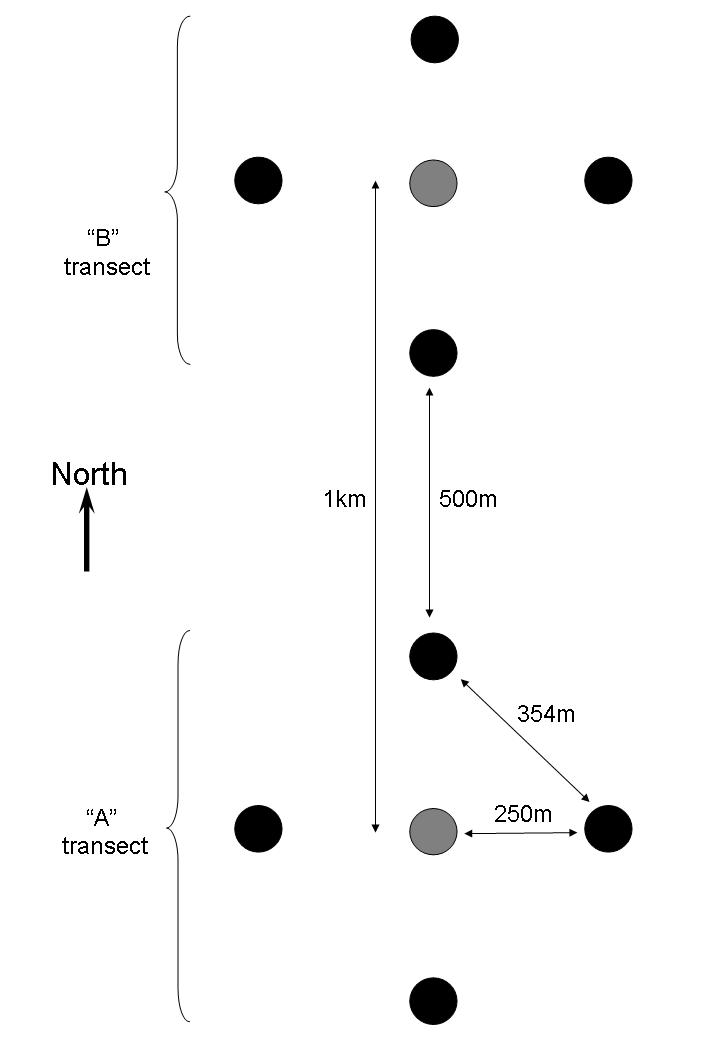
Point count survey locations are arranged in a diamond-shaped transect of four point count stations (black dots) surrounding one point count and call-playback station (gray dot) at the center (see figure), and two transects are located 1km apart in either a north-south, or east-west arrangement. The four outer points are 250m from the center point in the four cardinal directions (each outer point is 354m apart).
